
Wash Brook
Get to know the Wash Brook
The Wash Brook is a stream, floodplain, wetland, watershed, and community within the Sydney - Ashby area in Nova Scotia. It is an area beloved by each team here at ACAP Cape Breton and to so many community members who use this space daily.
ACAP Cape Breton aims to help steward this land ecologically along with many community partners. Restoration in this area is multi-faceted and has spanned several projects over the years.
Here are some of our ongoing and past projects:
The Wash Brook community and recreation hub contains Brookland Elementary, St. Marguerite Bourgeoys Parish, South End Public Gardens, Centennial Athletic Track, Tomorrow’s Legends Arena, Susan McEachern Memorial Ballpark, Bernie MacNeil Ball Field, and MacCormack Ball Field. Upstream, the Wash Brook is part of the Baille Ard Nature Trails.
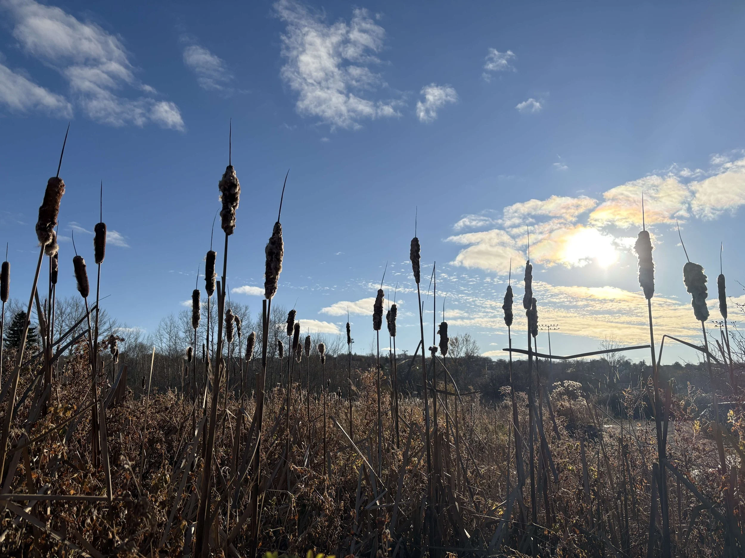
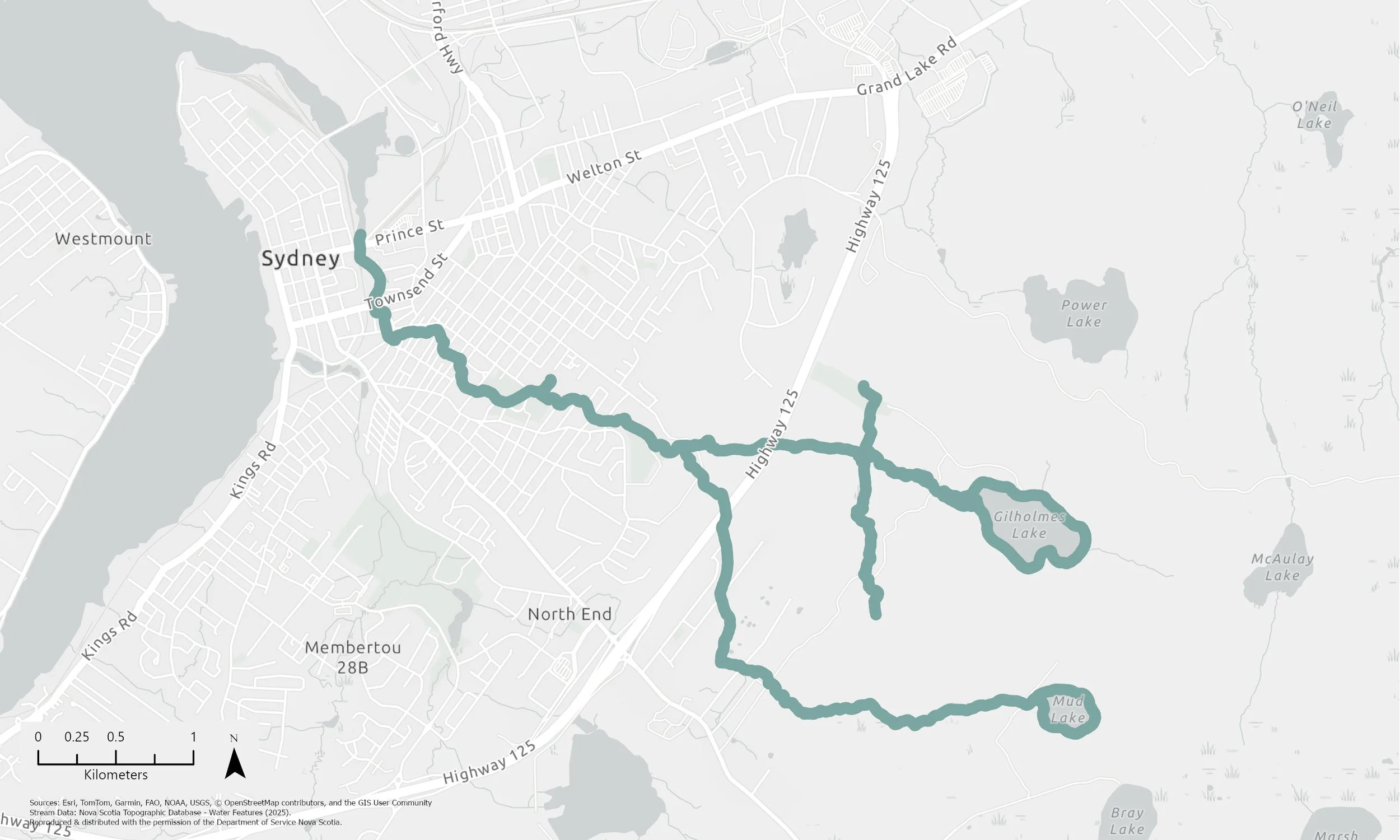
Wash Brook Stream
The Wash Brook flows from Mud Lake and Gilholmes Lake to the Sydney Harbour.
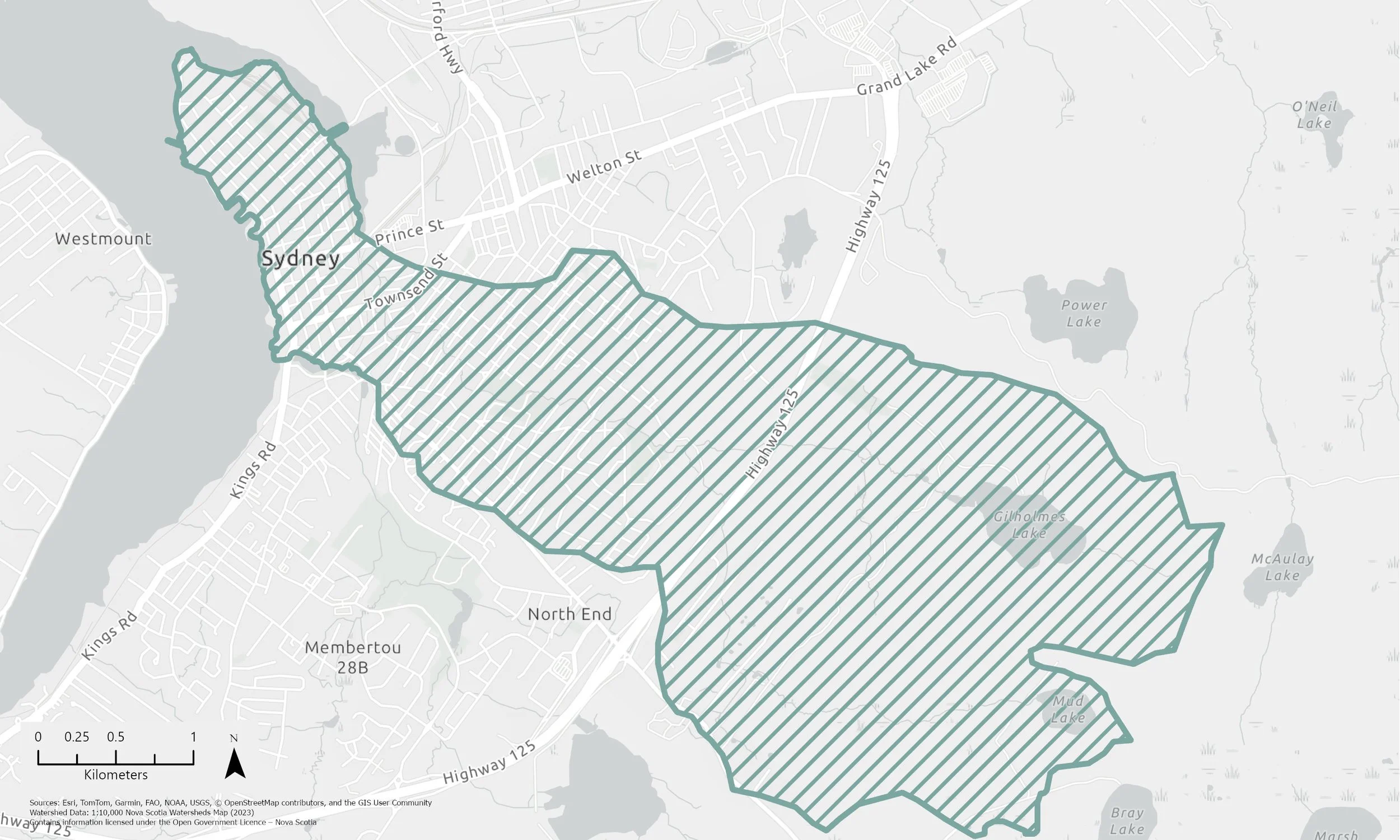
Wash Brook Watershed
Watersheds are defined by the natural topography. The edges of the watershed have the highest elevation and direct the water down the streams and lakes at the lowest elevations.
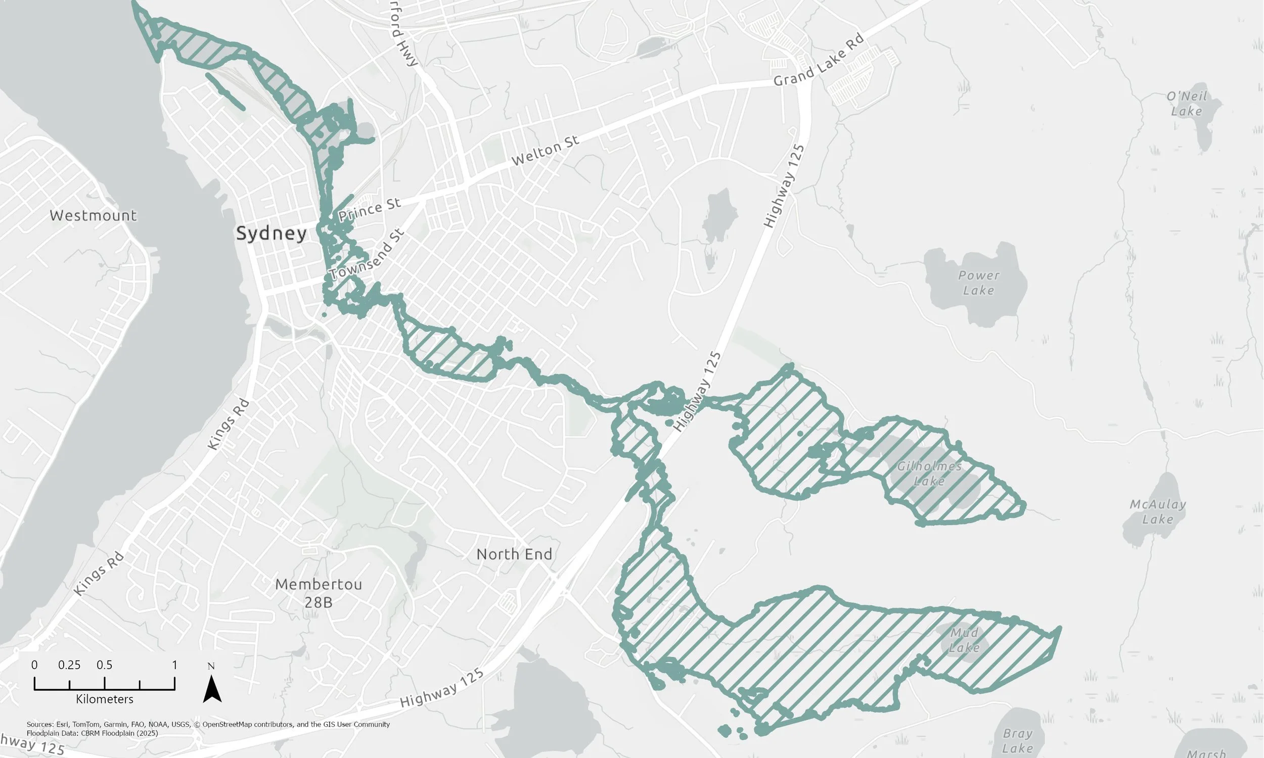
Wash Brook Floodplain
Floodplains are determined by the natural topography. They are flat areas of land adjacent to the streams and lakes that periodically hold water when the waterbody’s capacity to hold water is exceeded.
Wetland? What Wetland?
“Land […] that either periodically or permanently has a water table at, near or above the land’s surface or that is saturated with water, and sustains aquatic processes as indicated by the presence of poorly drained soils, hydrophytic vegetation and biological activities adapted to wet conditions.”
- Environment Act, SNS 1994-95, c 1, s 3, definition of “wetland”
The Wash Brook is an urban wetland, so some of its incredible characteristics might not be obvious at first glance. There are three different types of wetlands within this one urban corridor: a marsh, a swamp, and a riverine wetland.
-
The marshes at the Wash Brook are shallow freshwater marshes. A marsh only needs water to be present periodically and water levels will typically fluctuate throughout the season. When water is present, it will be standing or very slow moving. The marshes around Wash Brook receive water from surface run-off, groundwater, stormwater discharge, and periodic flooding.
These marshes have a mosaic of water channels and aquatic vegetation growing throughout. Typically, you will see large patches of broad-leaf cattails (Typha latifolia) and Canada bluejoint grass (Calamagrostis canadensis). These ecosystems are perfect for red-winged blackbirds, shorebirds, waterfowl, and amphibians. Marshes are typically highly nutrient-rich to support all of their vegetation and wildlife. Due to the volume of vegetation, marshes are also great contaminant and sediment filters.
-
This type of wetland is usually dominated by trees and shrubs and can often be overlooked as a wetland by the average observer. What makes a swamp a wetland is its high water table below ground (typically within 50 cm of the surface). Swamps can also have pools of standing or slow moving surface water. A swamp’s high water table below ground can usually be identified by the types of plants that grow there. Trees might include red maple, black spruce, balsam fir, and alder. Common understory plants might include sensitive ferns, cinnamon ferns, and mosses. The swamps at the Wash Brook occur along the floodplain of the stream and are recharged by the groundwater, precipitation, and flooding events.
-
This wetland type is simply an area situated immediately adjacent to rivers and streams. A riverine wetland can extend beyond the riparian area. Its water table is maintained by the level of water in the adjacent river or stream, therefore, it is subject to flooding when stream or river waters are high.
For more information about wetlands visit the NS Wetlands and NS Wet Places pages!
Resources:
Department of Natural Resources. (2018, August 14). Nova Scotia Wet Places - Floodplains. Government of Nova Scotia. https://novascotia.ca/natr/wildlife/habitats/nswetlands/floodplains.asp.
Department of Natural Resources. (2018, August 14). Nova Scotia Wet Places - Freshwater Marshes. Government of Nova Scotia. https://novascotia.ca/natr/wildlife/habitats/nswetlands/freshwater-marshes.asp.
Department of Natural Resources. (2018, August 14). Nova Scotia Wet Places - Swamps. Government of Nova Scotia. https://novascotia.ca/natr/wildlife/habitats/nswetlands/swamps.asp.
Environment and Climate Change. (n.d.). Nova Scotia’s Wetlands. Government of Nova Scotia. https://novascotia.ca/nse/wetland/.
National Wetlands Working Group. 1997. The Canadian Wetland Classification System, 2nd Edition. Warner, B.G. and C.D.A. Rubec (eds.), Wetlands Research Centre, University of Waterloo, Waterloo, ON, Canada.
Page updated: June 29, 2026