
Wash Brook Wetlands Restoration Project
About the Project
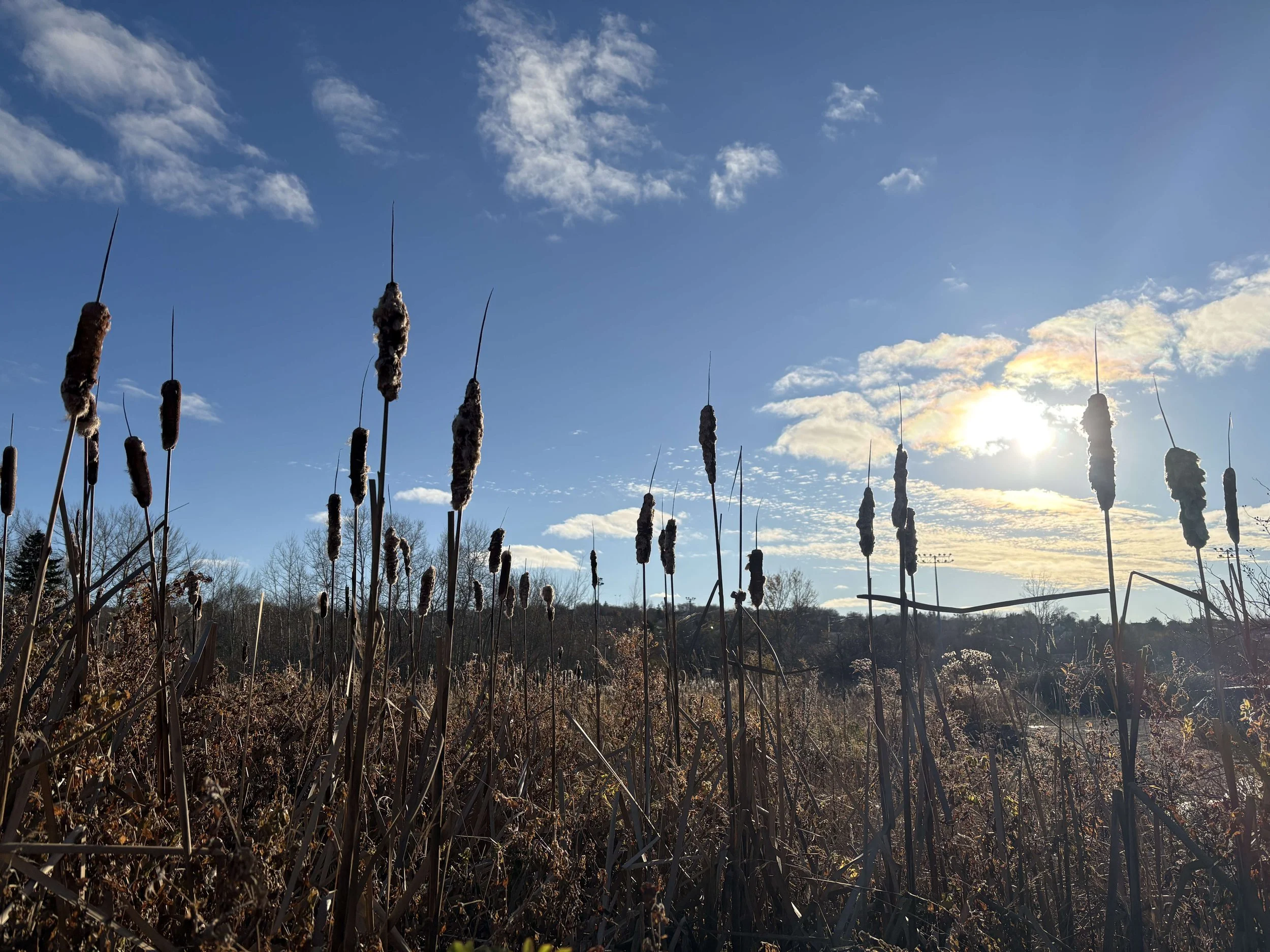
This project aims to restore and preserve approximately 2 hectares of urban wetland in Sydney, Nova Scotia. Much of the area surrounding the Wash Brook was historically a large wetland network before it was filled in for urban use. The restoration area is located within a floodplain and still exhibits wetland characteristics despite having been urbanized for over a half-century. Our goal is to combine ecological function with existing infrastructural function, resulting in a diverse system serving both the area’s human and non-human residents.
Under the Nova Scotia Wetland Conservation Policy (2011), any loss of wetland area must be compensated to achieve a no net loss of wetland area and functions. The preferred method of compensation is wetland restoration since it has the highest success rate and occurs at a 2:1 area-based restoration ratio. Restoration does not need to occur within the altered wetland site itself, but must be completed somewhere in the province at a Nova Scotia Environment and Climate Change (NS ECC) approved location.
In 2022, the Cape Breton Regional Municipality (CBRM) received approval to alter 1.4 hectares of wetland to build a waste water treatment plant in Port Morien. ACAP’s proposal for the Wash Brook floodplain to be the restoration site for the Port Morien compensation project was approved by NS ECC and supported by CBRM.
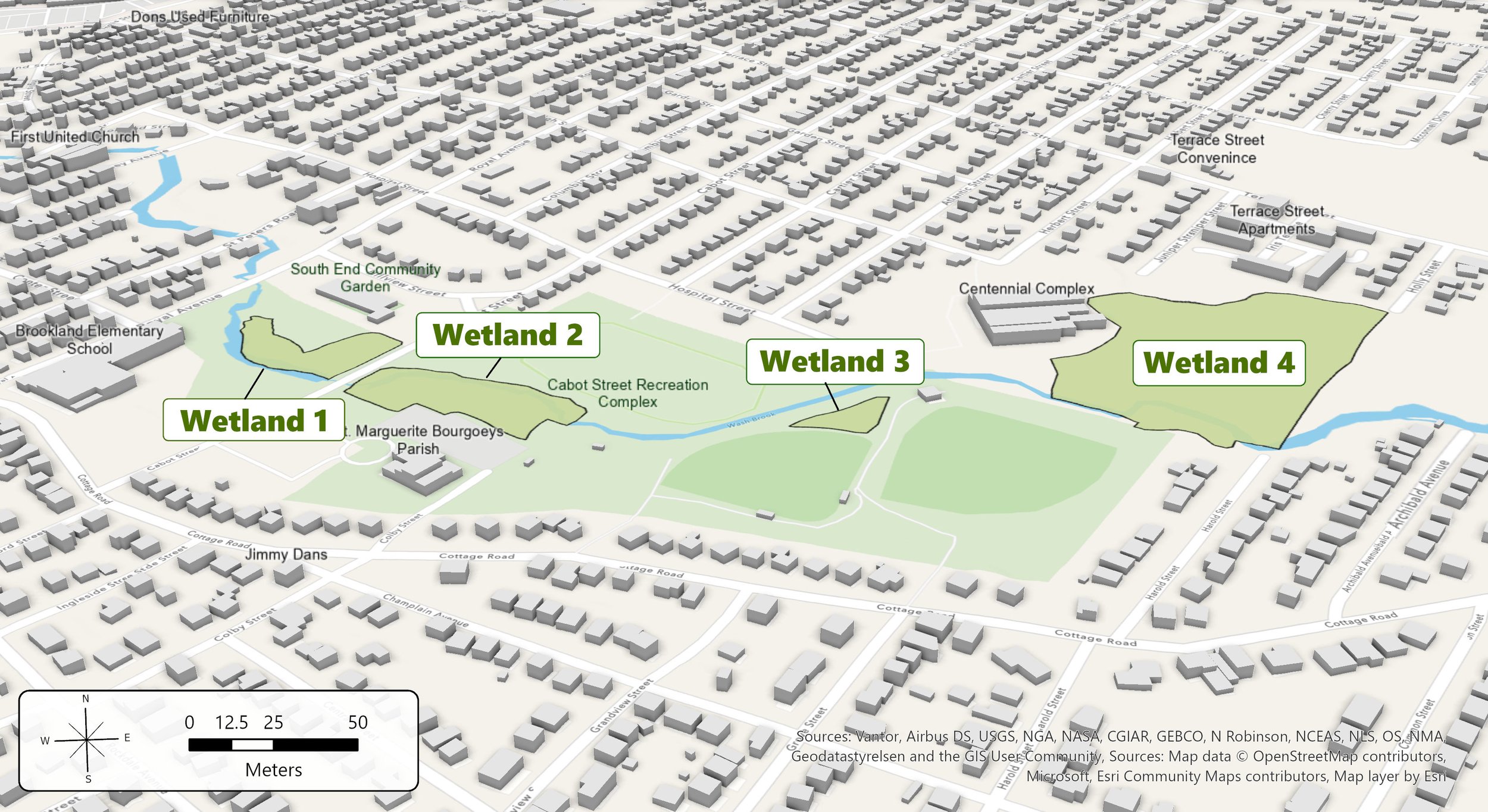
Delineated wetlands are labelled. These areas currently function as wetlands, prior to any restoration. The delineation was informed by hydrological, soil, and vegetation data.
Floodplain Considerations
Along the Wash Brook is a floodplain since the area’s natural elevation change creates a bowl in the middle reaches of the Wash Brook watershed. The floodplain has been put under strain from the past half-century of stream narrowing and urbanization, leaving the water to have nowhere to go.
Although not the intent of the this project, wetlands do have flood mitigating properties by creating more space for rain and flood waters to slow down, spread out, and be absorbed by wetland vegetation.
We are not creating retention ponds or plan on adding permanent pooled water to any of the areas. Any water that pools will be temporary and sporadic.
-
Local setting. Although the wetland restoration will not occur directly at the impacted site in Port Morien, it will remain in the Cape Breton Regional Municipality. Compensation activities are often outsourced to environmental organizations who can implement the activities anywhere in Nova Scotia.
Local partnerships. Where possible, ACAP is partnering with local landscaping companies, nurseries, schools, and community organizations to implement the restoration. ACAP will also host opportunities for community members to get involved with the restoration.
Urban setting. Urban wetlands are often overlooked and regarded as untapped development opportunities. However, this makes them that much more valuable as ecological corridors, habitat refuges, and water storage and filtration services. Due to additional infrastructural and social considerations, urban wetland restorations can be complex.
Monitoring first. Prior to any wetland restoration, the Wash Brook area was thoroughly monitored for various ecological metrics to inform restoration activities and to help understand activity impacts after restoration. Most notably, we set up groundwater monitoring wells throughout the Wash Brook. Read more about the Groundwater Monitoring Program below.
-
This floodplain has essential community infrastructure and is dear to many people’s hearts. Keeping this area healthy will give back to the community for years to come.
This area used to be covered in extensive wetland and still contains natural wetland remnants, despite development. We are simply restoring some of what was lost.
Wetlands are great flood buffers and help slow the flow of water.
Wetlands provide many essential ecosystem services, which is important in an urban area where natural habitat is already fragmented.
Services & Benefits:
Provides habitat, shelter, and breeding areas for a diverse range of organisms
Supplies food and resources for plants, animals, and microorganisms
Improves water quality by filtering sediments, nutrients, and pollutants, before they enter the stream
Slows stream flow and helps absorb stormwater, reducing flooding and erosion
-
Wetland restoration must occur at a 2:1 ratio, but what if the restored area can’t meet those size expectations?
Secondary compensation activities can help bridge the gap. An absolute minimum of 1:1 physical wetland restoration must take place and the remaining restoration can be compensated by activities approved by NS ECC, based on that activity’s monetary value.
The Port Morien wetland lost 1.4 ha. Compensation activities for this project must restore a total of 2.8 ha of wetland. Approximately 2 ha will be physically restored in the Wash Brook and the remaining 0.8 ha will be restored via secondary compensation.
Our secondary compensation includes our ground water monitoring program (started prior to restoration, see below), educational signage and programming, and barriers protecting remnant and re-established wetland from destruction.
Project Timeline
Fall 2026: Restoration Implementation Part 2
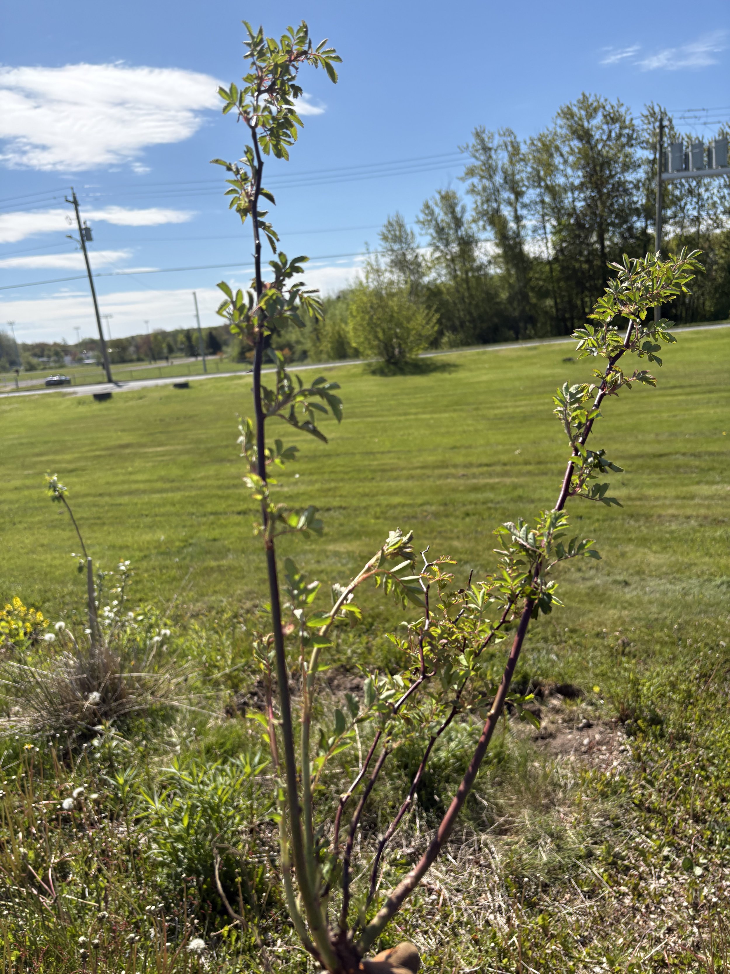
Large-scale invasive plant excavation (multiflora rose & Japanese knotweed)
Planting fall wetland species in excavated areas
Sod and fill excavation in targeted areas around the Wash Brook
Planting native wetland species in excavated areas
Installing educational signage
Keep your eye out for community initiatives coming this fall!
Spring 2026: Restoration Implementation Part 1
Planning for fall excavation
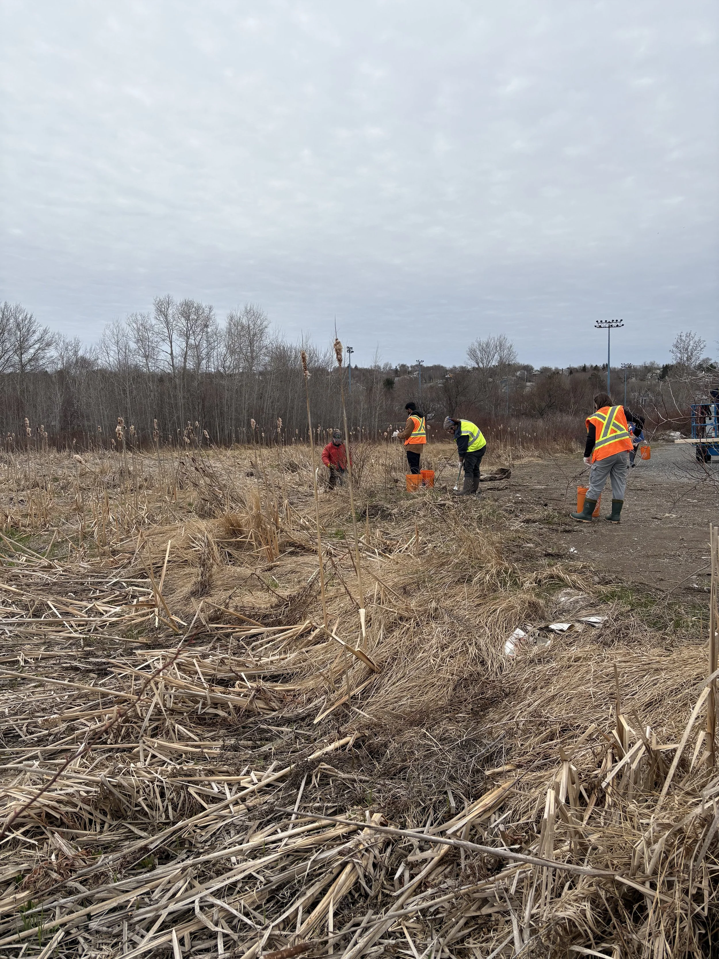
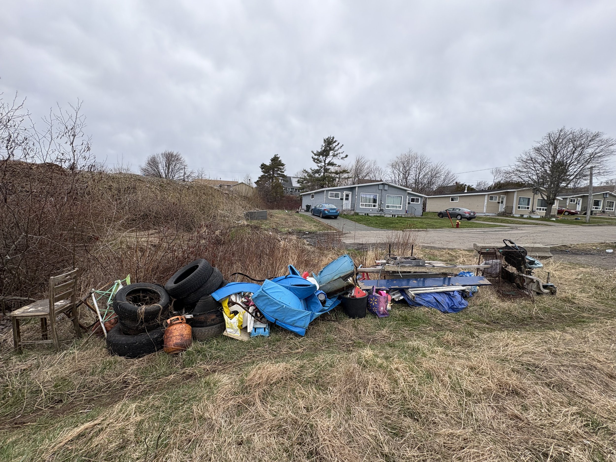
Garbage clean-ups
Small-scale invasive plant removal
Community engagement events
2025: Data Collection
Continuation of Groundwater Monitoring Program
Wetland delineation
Non-tidal Wetland Ecosystem Services Protocol - Atlantic Canada (WESP-AC)
Bird surveys
Vegetation surveys
2024: Groundwater Monitoring Program Implementation
Groundwater well installation
Data collection start
2023: Project Start
LOU between ACAP and CBRM for the Wash Brook wetland restoration project
Restoration Gallery
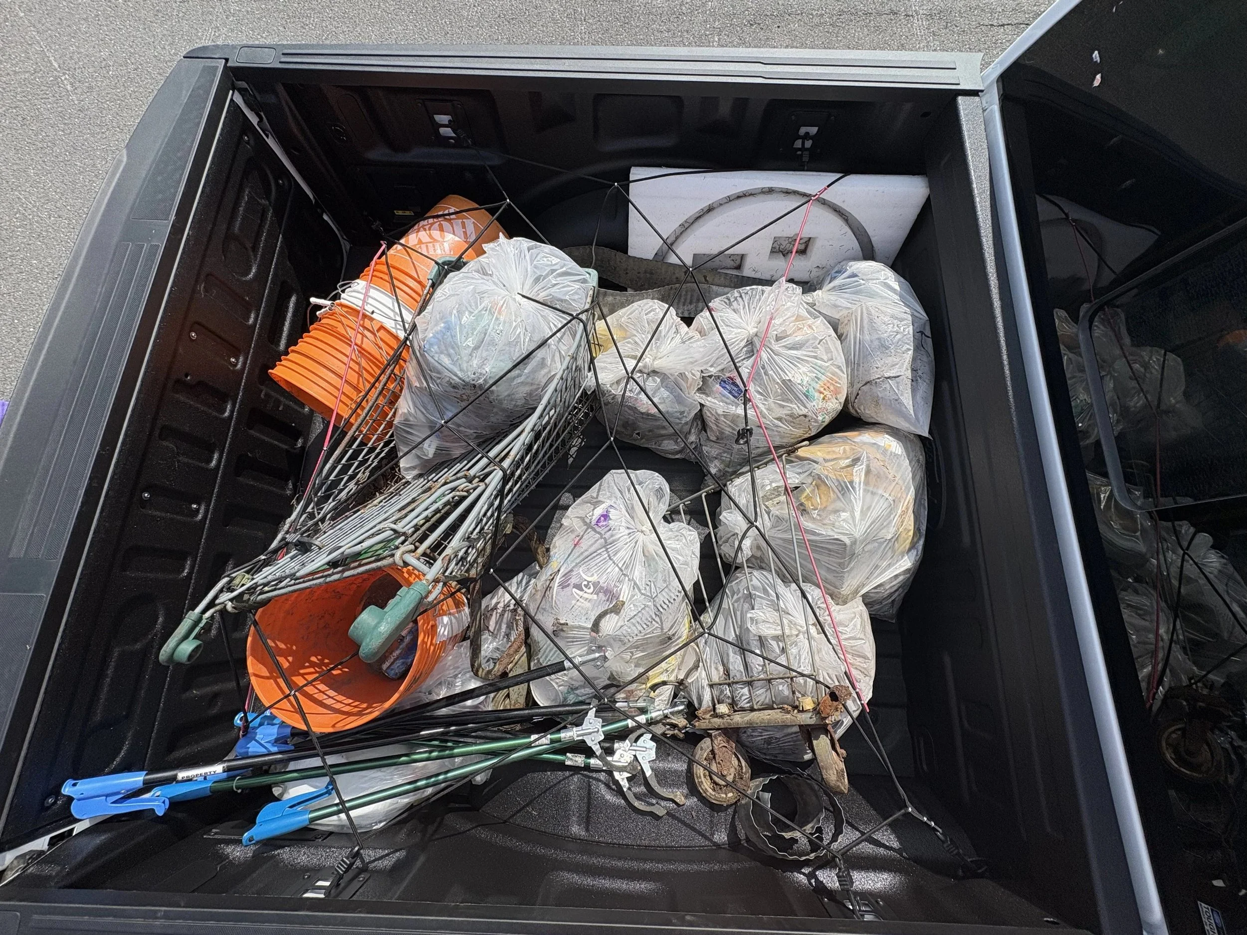
Wetland 4 garbage clean up with Riparian Zone Ready: Sydney. May, 2026
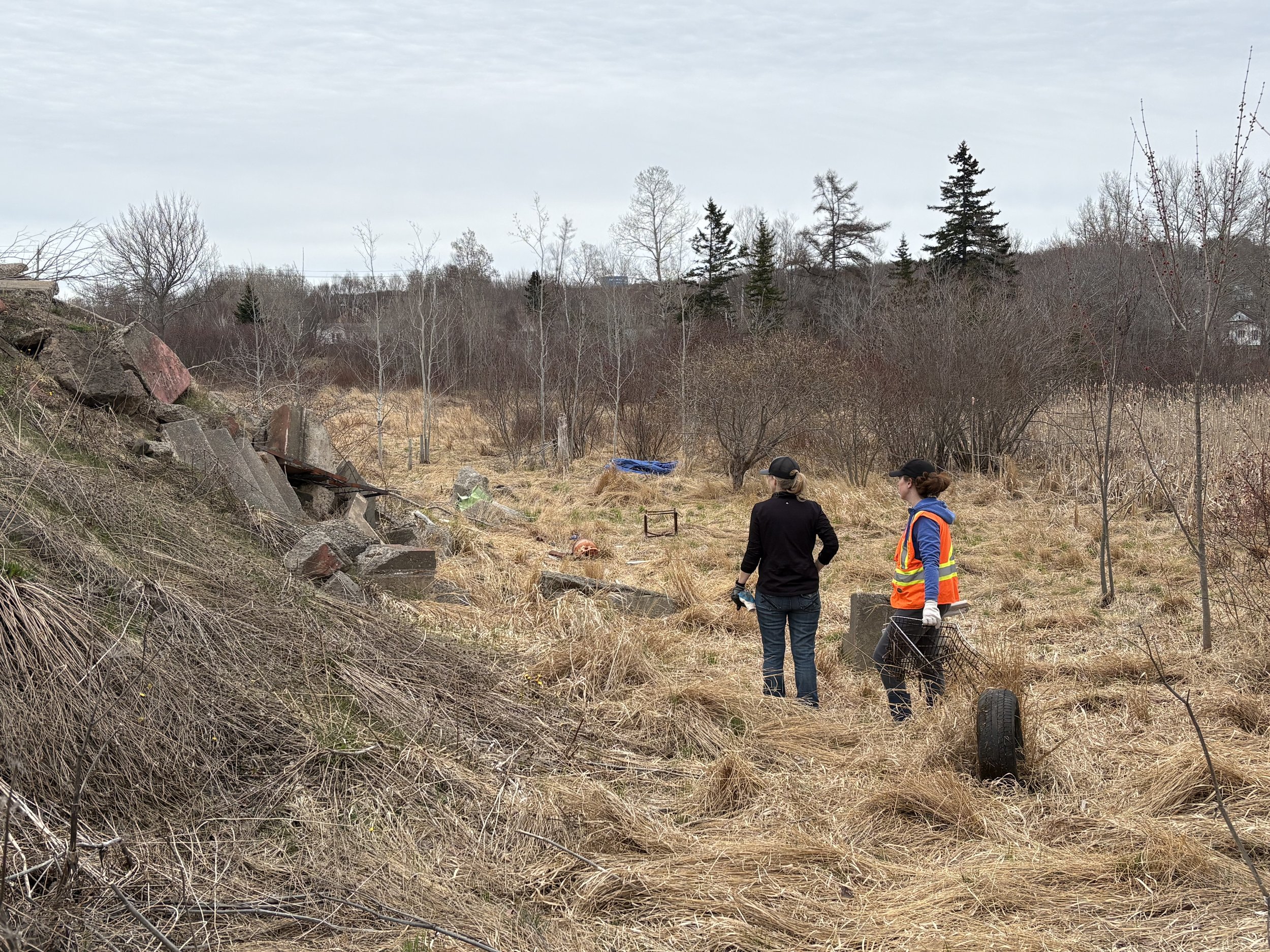
Wetland 4 garbage clean up with Riparian Zone Ready: Sydney. May, 2026
Wetland 4 garbage clean up with Riparian Zone Ready: Sydney. May, 2026
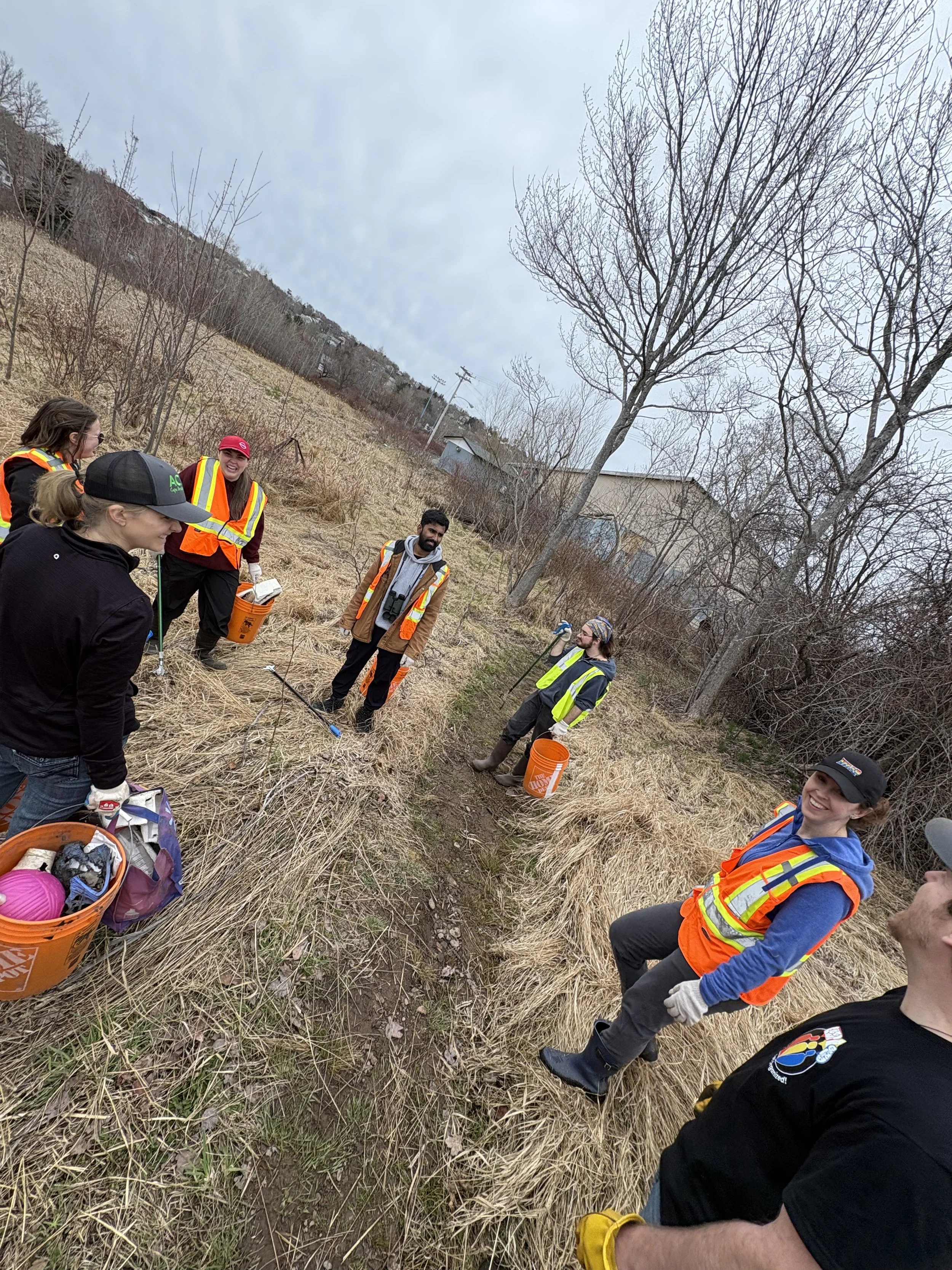
Wetland 4 garbage clean up with Riparian Zone Ready: Sydney. May, 2026
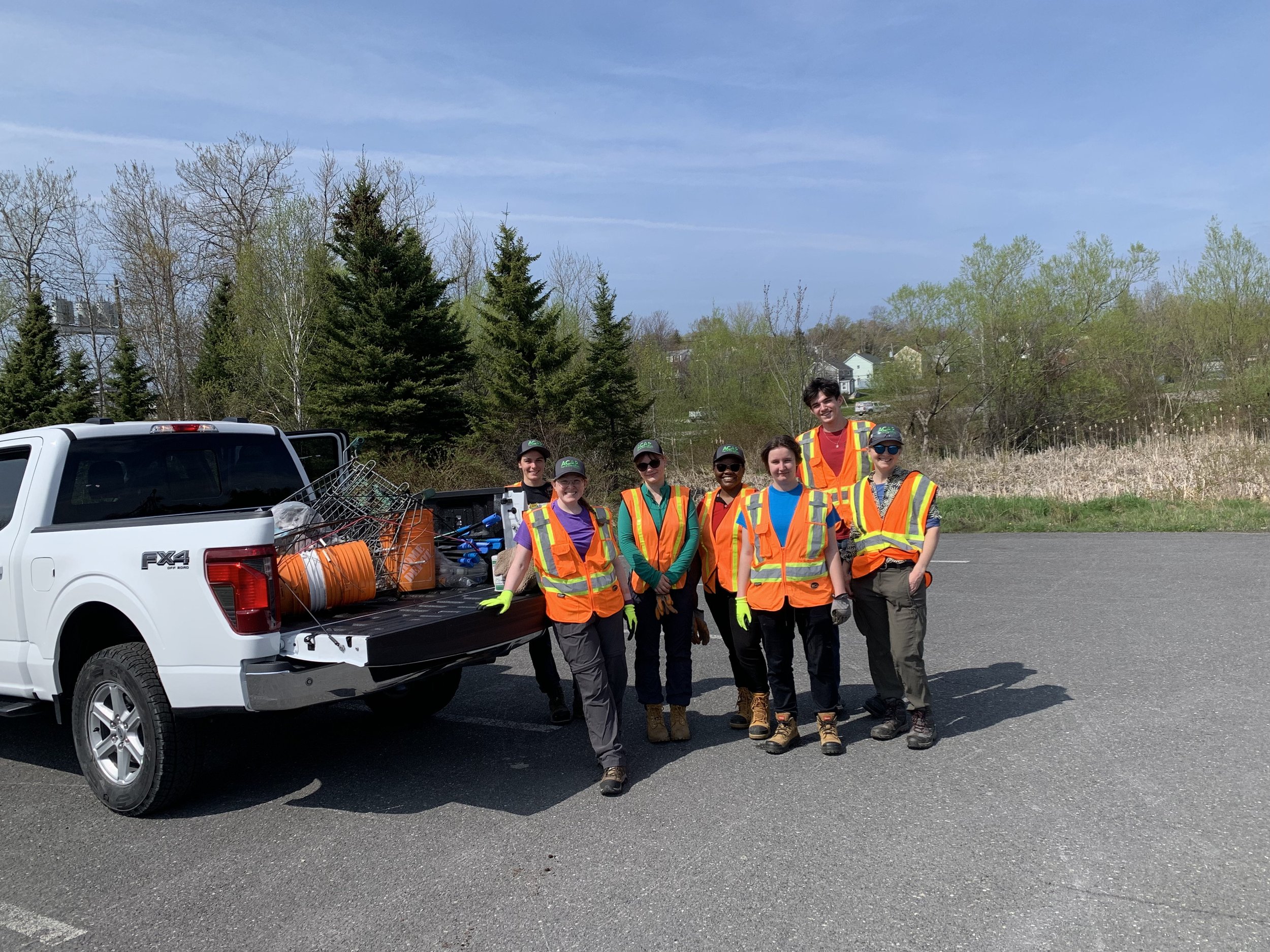
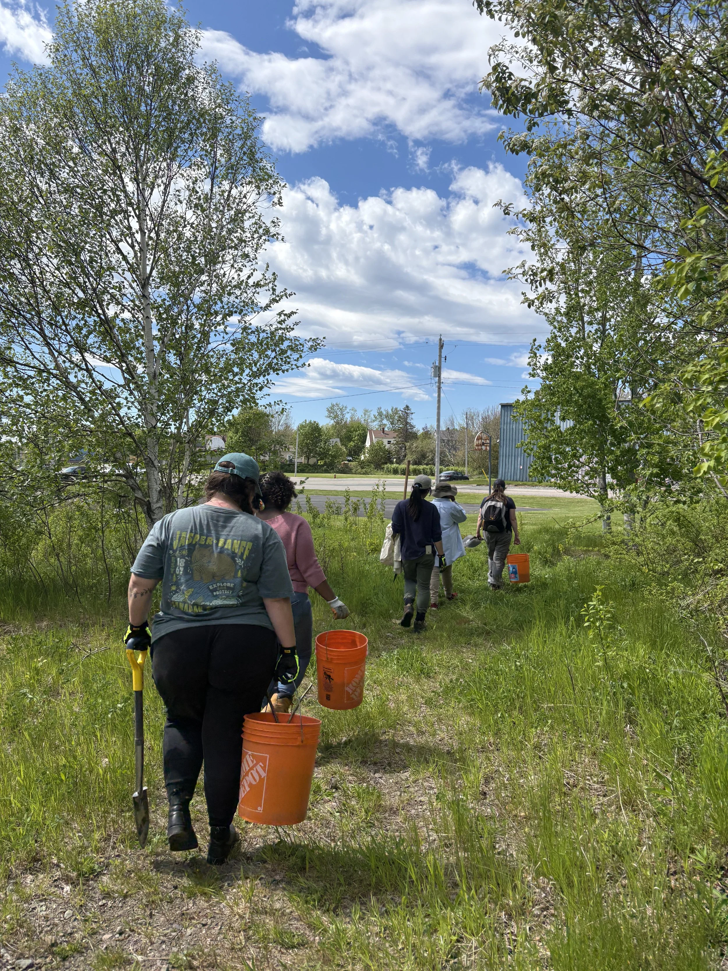
Wetland 1 & 2 garbage clean up with Trashformers. May, 2026
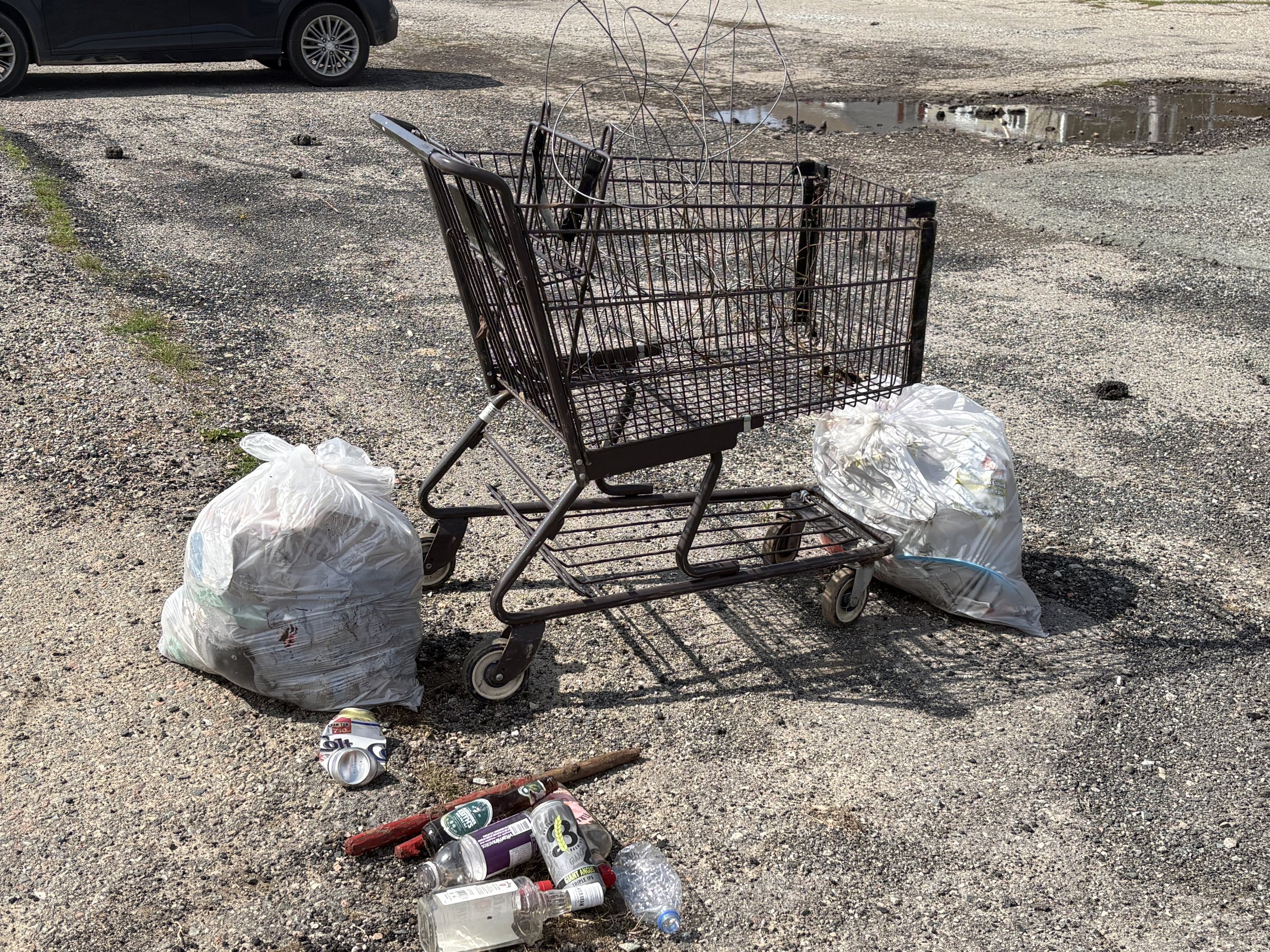
Wetland 1 & 2 garbage clean up with Trashformers. May, 2026
Wetland 1 & 2 garbage clean up with Trashformers. May, 2026
Multiflora rose removal. June, 2026
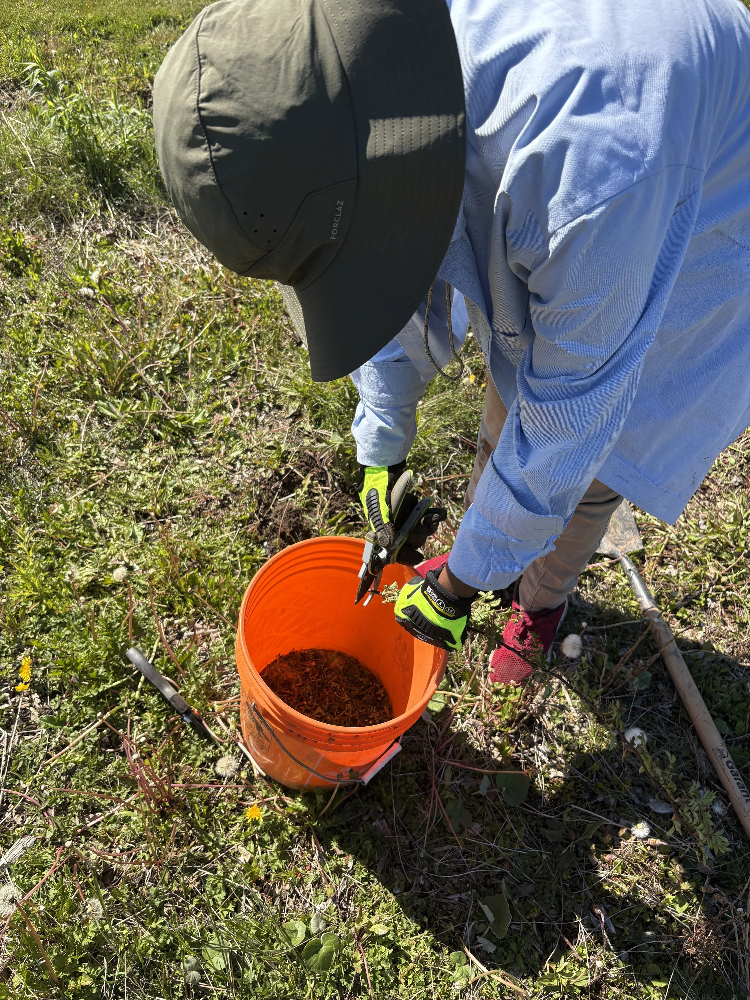
Multiflora rose removal. June, 2026
Multiflora rose removal. June, 2026
Details & Data
Groundwater Monitoring Program
Groundwater is monitored monthly in the Wash Brook using permanently installed wells. Groundwater levels are then compared to reference points in the stream to determine relative water levels.
Understanding groundwater levels is essential to designing an effective wetland restoration plan by informing excavation depths, plant species selection, and determining wetland re-implementation success. Groundwater levels were monitored a year prior to wetland restoration activities began and will continue until five years after the completion of physical restoration activities.
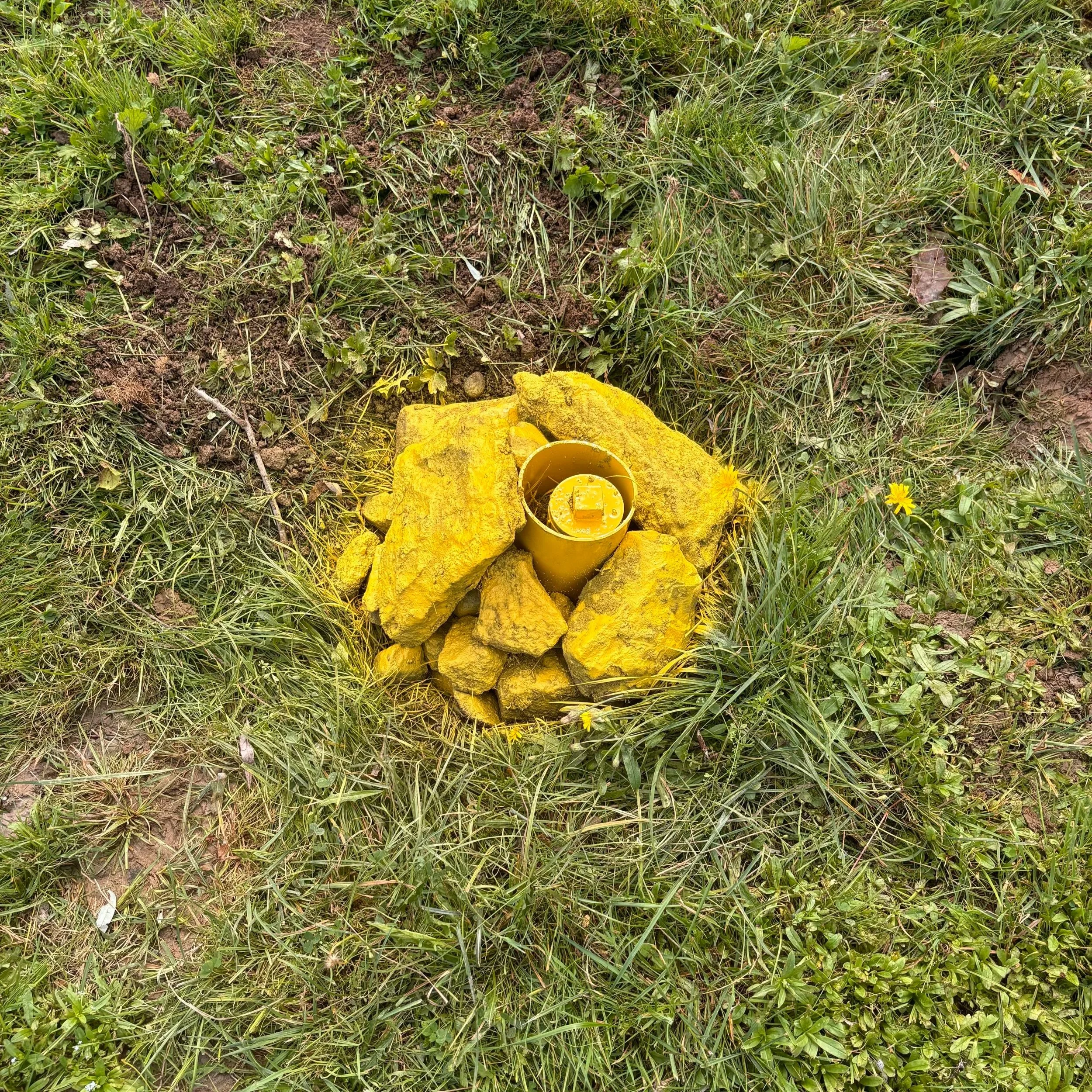
Monitoring well
This program was set up as part of the secondary compensation requirements under NS ECC’s Wetlands Conservation Policy. This program was informed by the expertise of Fred Baechler (senior hydrogeologist, EXP) and installation was performed by Booney’s Excavation Ltd.
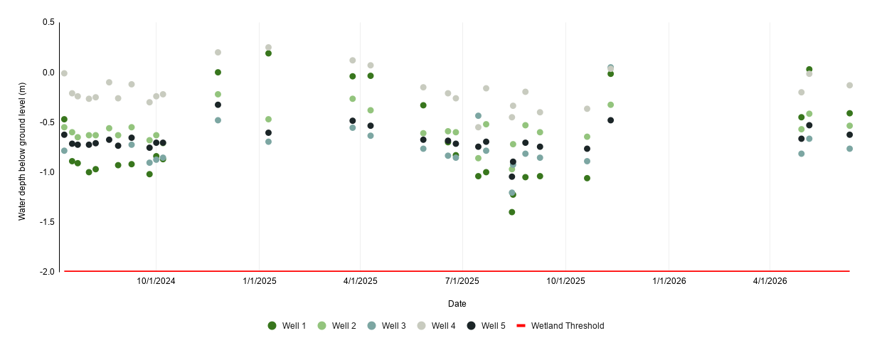
Groundwater data collected across the Wash Brook from 2024 - present. Ground level represented by 0.0 m. The wetland threshold (-2 m) is chosen based on the Provincial definition. Last updated: June 2026.
Citizen Science
Are you curious what plants and animals have been recorded at the Wash Brook? Want to contribute to our restoration efforts? Become an active iNaturalist user in the Wash Brook!
Any observations submitted within the watershed boundary will automatically be added to ACAP’s Wash Brook iNaturalist project: Life at the Washbrook.
Wetland Ecosystem Services Protocol - Atlantic Canada (WESP-AC)
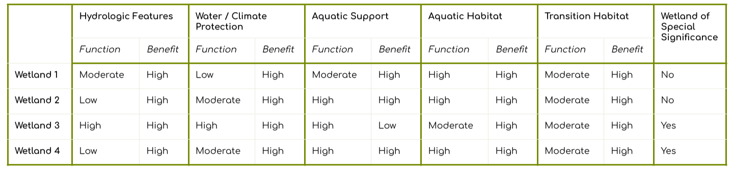
A WESP-AC assessment is a tool designed to identify and standardize ecological functions and benefits that a wetland provides to the ecosystem and its inhabitants. WESP-AC has an additional built in calculator to help determine if a wetland could be considered a Wetland of Special Significance (WSS). These types of wetlands are awarded additional protections by NS ECC. Four wetlands were identified and delineated by a professional in the Wash Brook floodplain and a WESP-AC assessment was completed for each of those delineated wetlands. A WESP-AC assessment was completed prior to restoration activities and another will be completed five years after restoration is complete.
Wash Brook WESP-AC Findings
WESP-AC provides a function and a benefit score for each category. The score is based on a Provincial wetland reference.
Function: how well the wetland is functioning physically / ecologically.
Benefit: how much do the surroundings benefit from the wetland’s functioning (including societal and economic values).
The wetland categories are the following:
Hydrologic: How effectively a wetland stores water and delays downslope movement of that water, thereby influencing potential flooding events.
Water & Climate Protection: how effectively a wetland helps improve water quality and support a healthy environment by trapping sediment, reducing erosion, removing excess nutrients in the water, and storing carbon long-term.
Aquatic Support: how effectively a wetland helps maintain stream flows during dry periods for fish passage, how effectively a wetland produces and exports organic nutrients, and how effectively a wetland supports the production of algae and plants that make up the base of the aquatic food web.
Aquatic Habitat: a wetland’s capacity to support an abundance and diversity of native fish for functions other than spawning, amphibians and turtles, and feeding and nesting waterbirds.
Transition Habitat: a wetland’s capacity to support an abundance and diversity of songbirds and raptors, native plants, and pollinating insects and birds at multiple spatial scales.
Page updated: June 29, 2026